
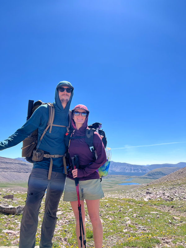
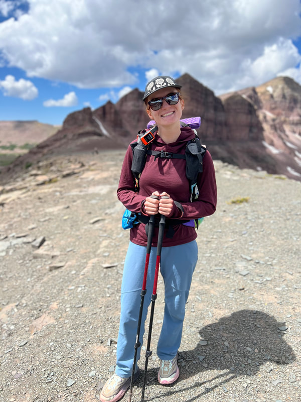
My partner and I hiked the Uinta Highline trail, from Leidy Peak to Hayden Pass over 6 days from August 5-11, 2023. The 90 miles (that was supposed to be 80 but thanks to snow fields and blow downs added up to more) was amazing and brutal simultaneously, but such a wonderful experience overall!
Pre-Trip Planning:
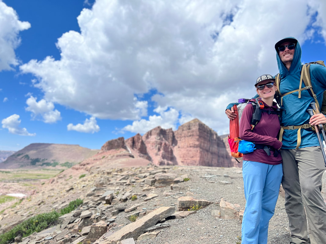
This hike felt like four years in the making, especially considering how much time my partner, Kevin, and I spent hiking in the Uintas since moving to Salt Lake in 2019. We’ve gone back and forth about doing this for a while, but I’ve been pushing hard for this so we committed to doing it this July. Snow conditions this year meant that wasn’t feasible, so we pushed it back to the last week of my summer break, hoping weather conditions would cooperate!
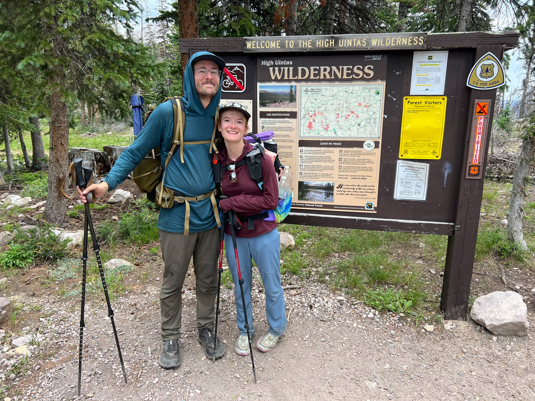
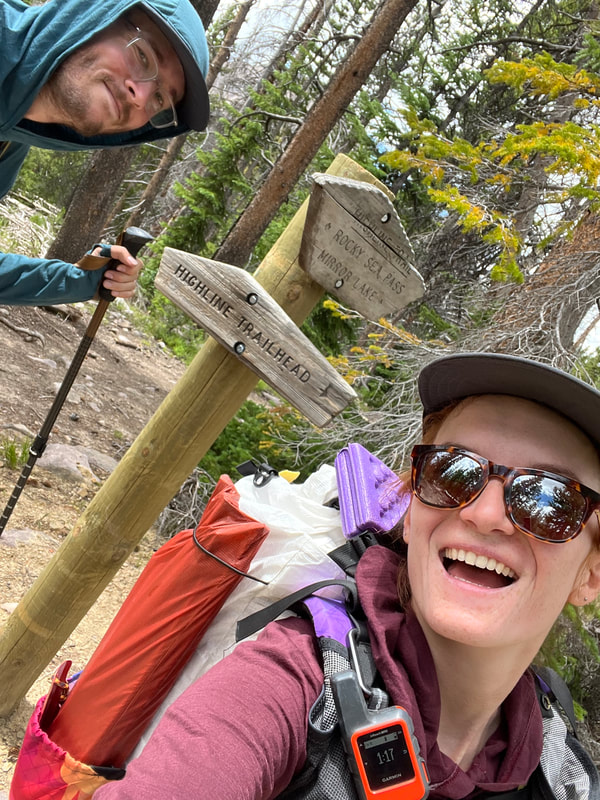
We went back and forth for a while about whether or not to hike the full UHT, starting at McKee Draw, which from everything I’ve read and heard from friends is a pretty boring and water-less 20-mile trek. Unfortunately, Kevin got very sick with Covid just three weeks before our start date, causing him to miss the preceding training hikes we’d planned which put the whole hike in jeopardy. After he began recovering and experienced awful elevation sickness on a training hike the weekend before, we knew it was too risky to fit the full hike into the 8 day window we had, so this pretty much made the decision for us to start at the Leidy Peak Trailhead, cutting off the first ~20 miles of the easternmost section of this hike. The Leidy Peak Trailhead is a pain to get to, but thankfully Mountain Trails Transport is running shuttles to/from McKee Draw, Hayden Pass and Leidy Peak Trailheads. It cost us $200 each to get picked up at Hayden Pass (where we dropped our car), and get driven to Leidy Peak. Our driver and his wife met us at 9:30am (later than we’d hoped but that was the only time that would work for them) on Saturday. Starting Saturday 8/5 meant that at the absolute latest we had to finish by Sunday 8/13, as we both had to work Monday 8/14. We prepped food for 8 days, but an itinerary for 5 days, giving us flexibility in case storms rolled in or we needed a slower pace. I made this AllTrails map with waypoints/notes using this UHT guide. This was our primary navigation tool on trail, although I also brought the High Uinta Wilderness paper map, which we didn’t use once. Food Prep:
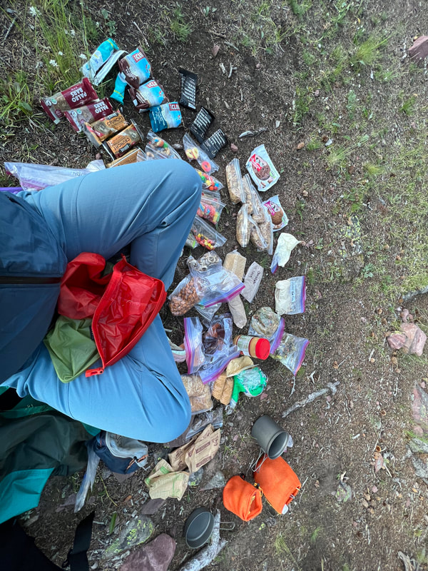
Honestly food for potentially 8 days was a nightmare to figure out. Planning for 2-4 days feels reasonable and we often throw in luxuries ignoring weight, but that wasn’t an option for us this trip. Here’s a pretty detailed spreadsheet I made with all the food we brought on the trip. Initially we had 24lbs of food and after feeling our packs we impulse cut a bunch and ended up with 18lbs of food. It was technically enough to get us through 7 nights, but we’d be running a calorie deficit regardless so we started eating a lot more once we realized we’d be done in 6 nights.
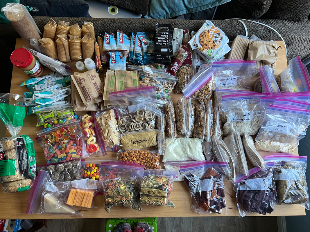
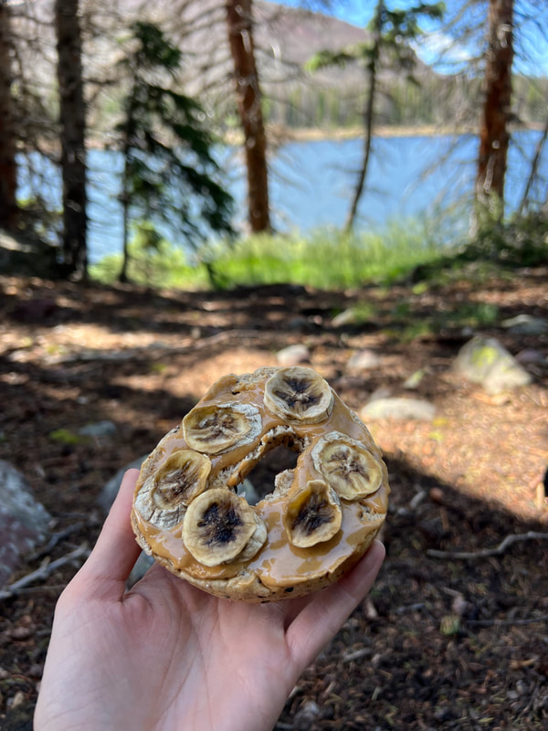
Food Thoughts - dehydrated hummus was the best damn thing. Honestly, I haven’t been so happy with food on trail in a long time, something about hummus and crackers, especially when rehydrated with cold stream water, just felt perfect. Lunch most days was half a bagel with peanut butter and dehydrated bananas, with crackers and cheddar cheese or hummus and a bunch of candy.
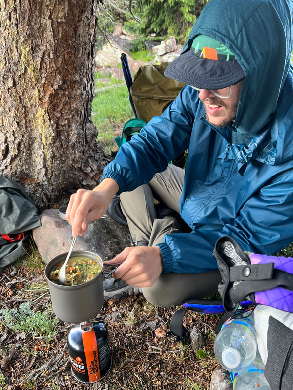
I don’t love the dehydrated milk, probably because I don’t normally drink milk. So I put the summit cereal in my oatmeal with peanut butter which made it hearty and delicious. The noodle and veggie meal is incredibly fibrous, which is all fine and good until you start running low on TP ? The Huel dinner was tasty, but the noodles never really rehydrated, this was even an issue when we tested at home prior to going. It was our first time using purchased dehydrated or freeze-dried food, and I prefer just making it myself.
Trip Report
Day 0: Shuttle, Lightning, Attempting Gabbro Pass – 6 miles
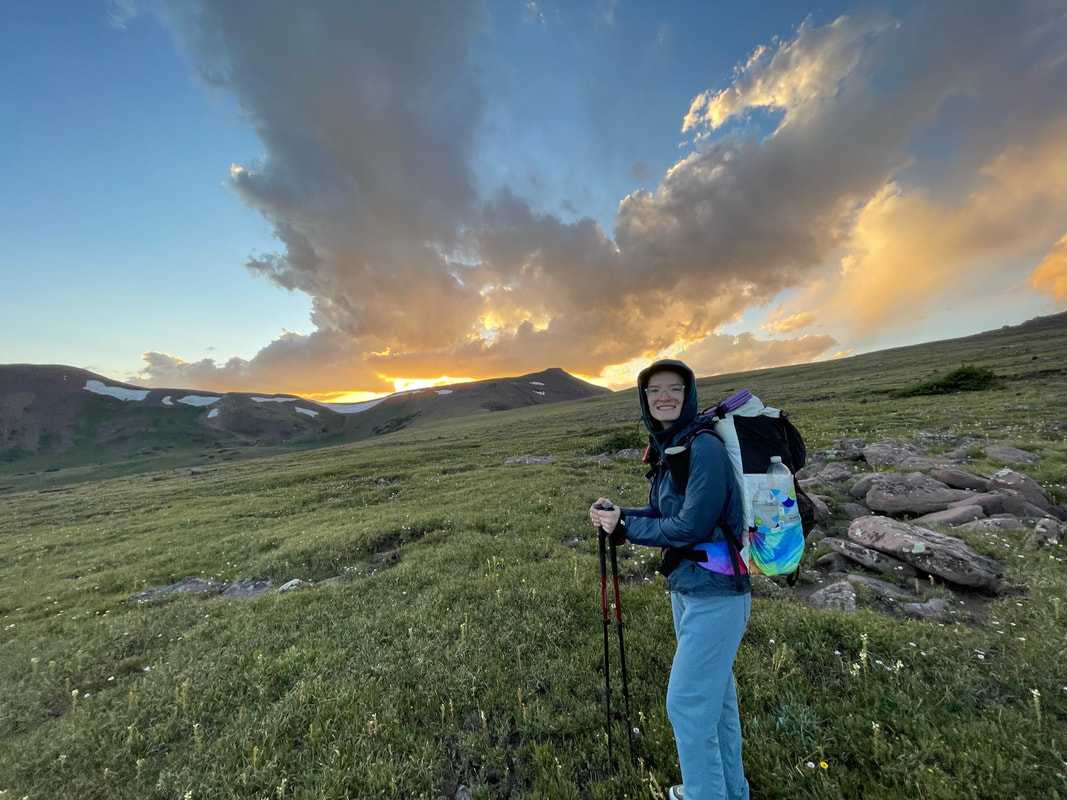
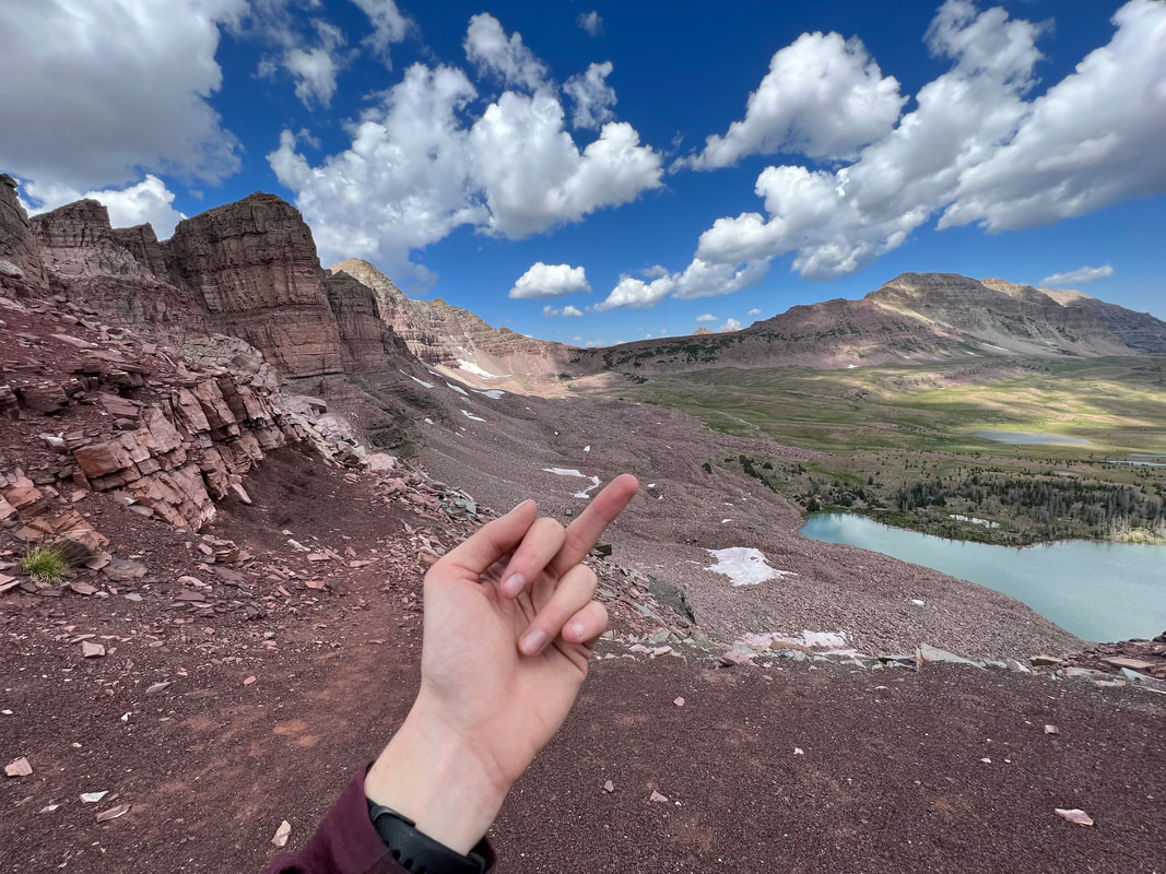
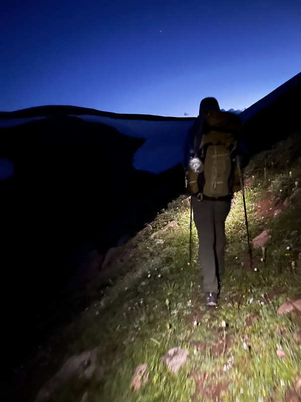
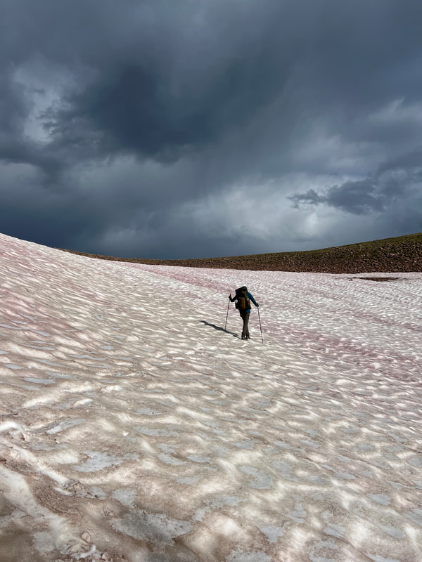
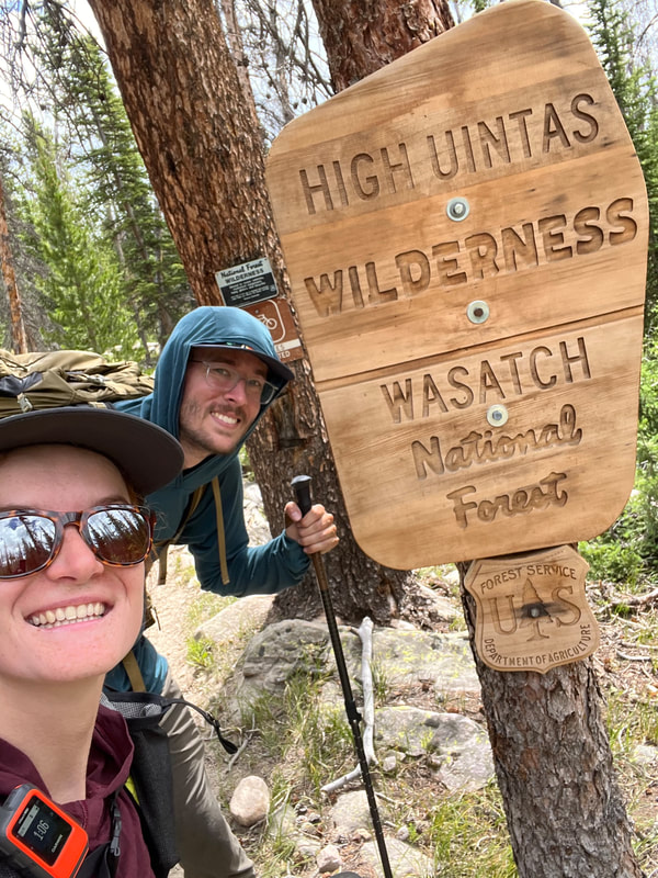
We left our house at 8am, arrived at the Hayden Pass trailhead right at 9:30am, and found our shuttle driver had snagged us a spot in an already overflowing parking lot. We hit the road by 9:45am and after a few bathroom and snack breaks along the drive, arrived at the Leidy Peak trailhead amid a raging thunderstorm at 2:30pm. Our shuttle driver, Clay, and his wife offered to sit with us in the car until the storm cleared, but there was no end in sight. We got out, thanked them and hit the trail. It was absolutely freezing so I threw on my hiking pants over the shorts I'd planned to wear. Then about ¼ mile from the trailhead lightning and thunder got way too close for comfort so we took shelter in some trees, and made a makeshift tarp shelter using our tent’s groundsheet. Rain and hail pelted us for over an hour as thunder loomed overhead. We immediately regretted our decision to do this hike, considered calling Clay to come pick us up, and felt like absolute idiots waiting out a storm that lasted hours. Every 45 minutes or so we’d brave the trail, just for lightning, thunder and hail to once again send us for the trees. We knew there was a long stretch without shelter about a mile from the trailhead, and didn’t feel comfortable being that exposed in this storm. At 6pm we made dinner, as more hail pelted us in the trees, and we didn’t start hiking until 7pm, almost five hours after being dropped off. Needless to say we were quite defeated, but we were greeted by a beautiful sunset once we started our hike towards Gabbro Pass. Since this was quite a nothing burger in trail descriptions, we attempted to summit at night – following the AllTrails map I’d made using the UHT guide recommendation to hike around the north of Lake Wilde. Well, what we didn’t realize is there was a giant and incredibly steep snow field blocking this route over the pass. After about an hour trying to scramble the boulder field on the side of the snow field, we retreated and set up camp by the only tree cover around, knowing we were sharing terrain with cattle grazing the area, and worried about the lightening overhead. This was a horrendous beginning to our hike that had us defeated and ready to call it quits, we’d hoped to make it twice the mileage and so I’m calling this Day 0 because we barely got a start. 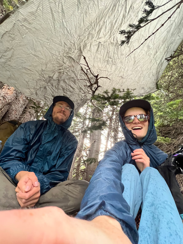
Ten minutes into our hike we took shelter under our ground sheet as thunder rolled in.
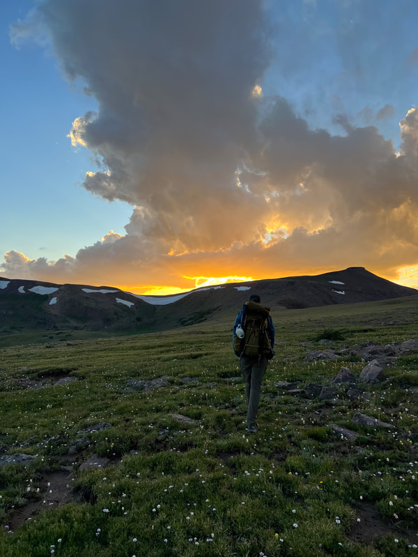
Sunset over Gabbro Pass as we finally hit the trail and made our way towards Lake Wilde.
Day 1: Gabbro Pass to Lower Reader Lake - 11 miles
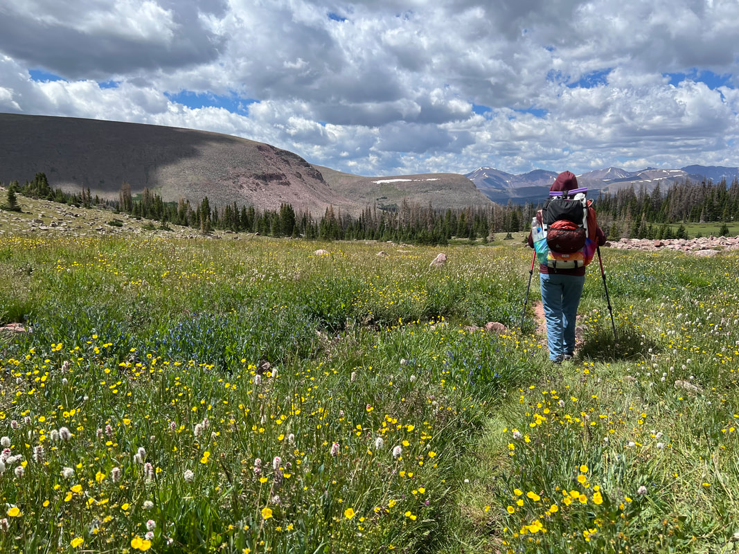
We woke up around 7:30am, Kevin had a raging headache and felt incredibly nauseous. We’d slept at 11,300ft, and he thought it was the elevation impacting him. After checking out our campsite in the daylight we were proud of ourselves for choosing the most sheltered place in the area. We followed the southern route around Lake Wilde to get over Gabbro Pass. In daylight it became very clear there was no way to get through the snow field on the northern trail. Weather cooperated despite daunting skies and we made it over the pass easily, and descended towards Deadman lake as dark clouds blew in and cleared rather quickly overhead. Dozens of cows were running around in the fields. When we got to Deadman lake we filtered water, ate some snacks and regretted not making it at least to here the night before. We passed several well-established campsites that would’ve been great to camp at. We passed one group of father and adult kids who were hiking to Fox Lake. The dad commented we’d be unlikely to see them again as he’s “old, fat and bald” so they’re slow hikers. We ran into them three more times as we played leap frog throughout the day. We stopped for lunch at White Rocks Lake, again wishing we’d made it there the day before. I dried out my socks which were wet from walking through marshes earlier in the day. Then moved along and ate dinner at Chepeta Lake, which was cut short by a thunder storm rolling in and dumping hail. We quickly packed up and kept hiking, only to encounter horrendous marshes on the west side of Chepeta Lake. By this point, barely more than 24 hours into the hike, I was deeply regretting wearing my trail runners (Hoka Speedgoat 5s), as Kevin hopped along through wet terrain with his Hoka GTX mids which kept his feet dry the whole trip. Every time my shoes dried out, we’d encounter more marshy, wet terrain and boom, wet feet again. We got to Lower Reader Lake around 6pm, at which point I was ready to take my shoes off and call it for the day. We set up camp at a little site between the lake and its outflowing stream. Another pair came through that were hiking the Highline shortly after we arrived and they set up camp not too far from us. We got a good night sleep at 10,7000ft, alleviating Kevin’s headache. From then on we did our best to sleep below 11k to help his elevation sickness. Still behind schedule we considered options to bail before Anderson Pass. 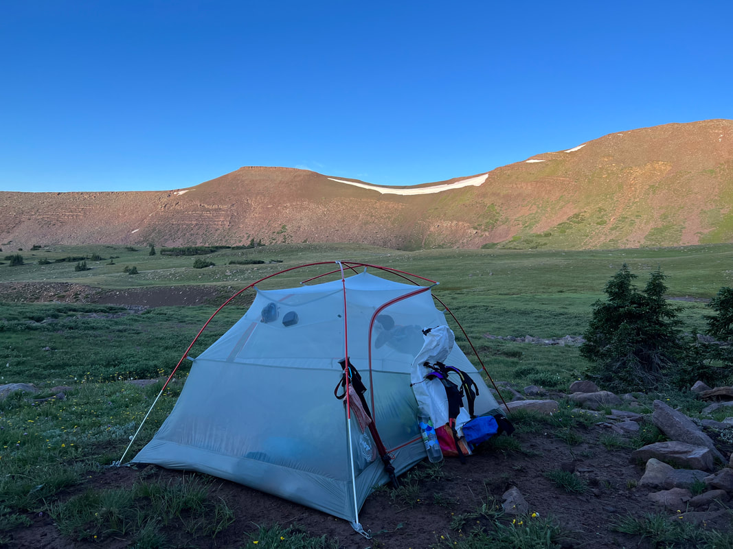
Campsite night 1, Lake Wilde
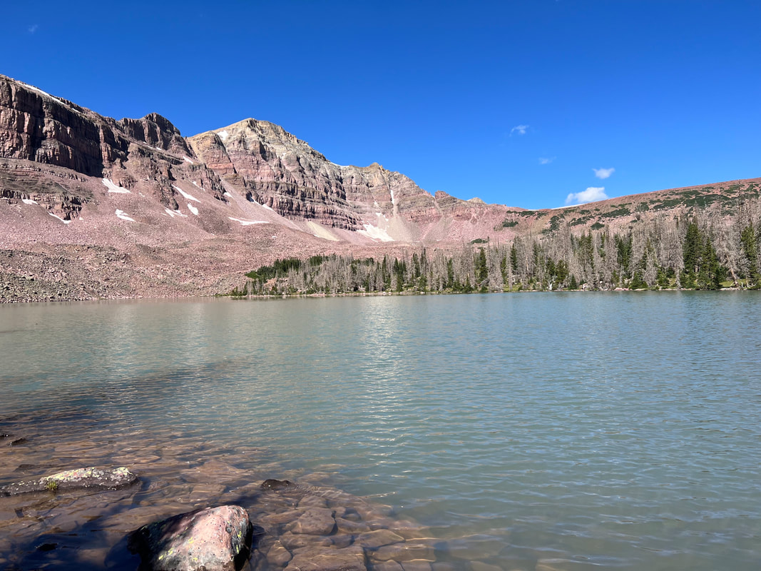
View of Deadman Lake, Gabbro Pass and Leidy Peak as we made our way to Reader Lakes Basin.
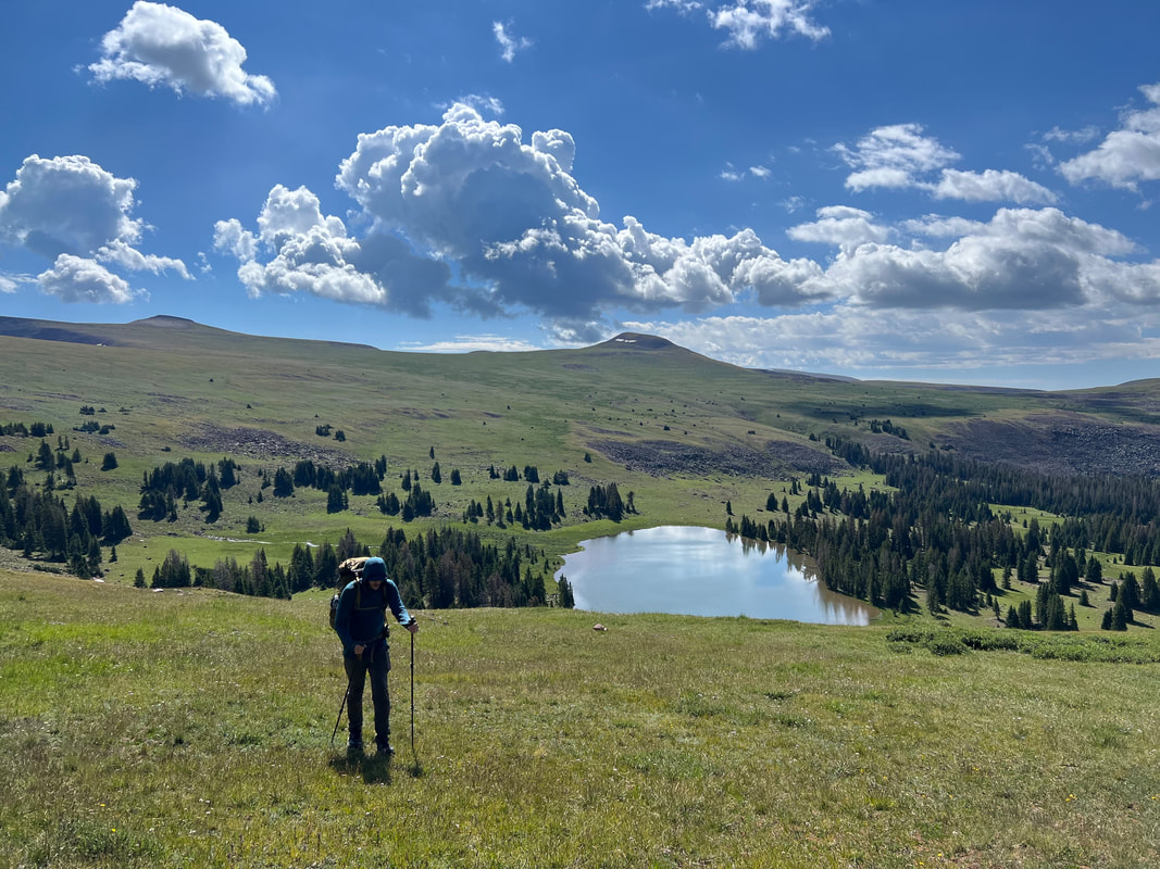
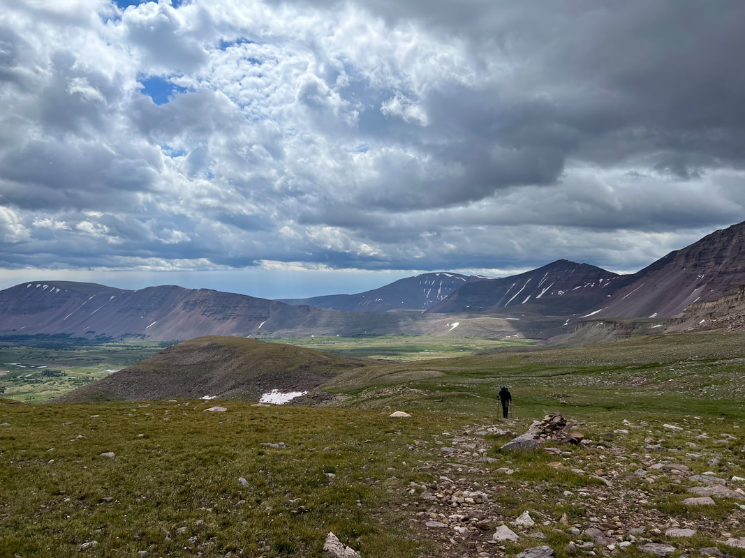
Day 2: North Pole Pass, Fox Lake, Kidney Lakes, to Gilbert Creek – 14 miles
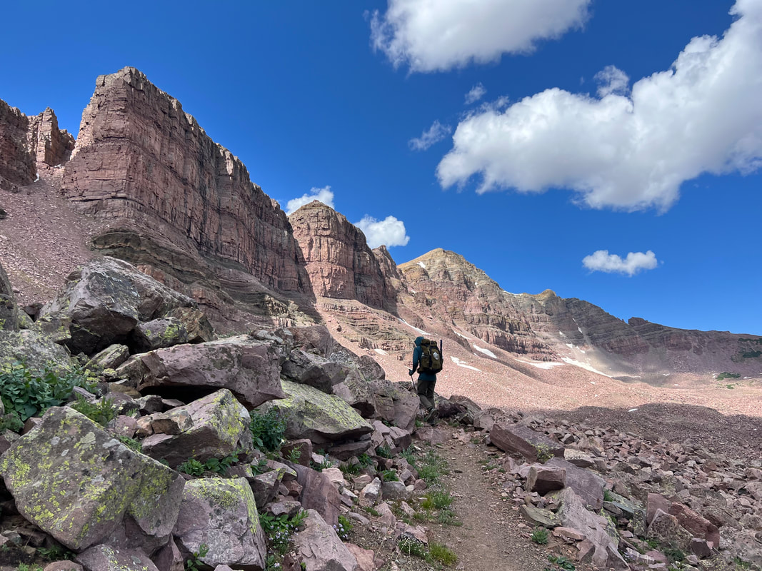
Tried to wake up early to get over North Pole Pass before afternoon storms, but we were both sluggish. Finally hit the trail around 9am and were convinced this would be our last day as we were so behind schedule. As we neared the end of the tree line towards North Pole Pass we wavered about whether or not to attempt this notoriously long pass with dark clouds looming and strong winds. I ran a premium weather report on my inReach which said there was a 0% chance of precipitation and we decided to make the push. About ¼ mile up the ascent a switch flipped for me and I got so pumped, basically trail running to the top. This pass is fucking gorgeous, the ascent felt like endless rolling meadows with gorgeous views behind us of Reader Lakes Basin. The wildflowers were insane, I just couldn’t get over the views, I was so stoked. Kevin was lagging behind so I had time for lots of selfies at the High Uinta Wilderness sign at the top of the pass. From the top of North Pole Pass I became determined to keep going on this hike, and really wanted to catch up to our initial itinerary. The next day we ran into a family that got caught in a snow storm on this pass and were throwing in the towel before Anderson, so I’m really glad we made it over with great weather as this pass seemed to really impact the mood of hikers. After descending North Pole Pass we stopped at Fox Lake for a long lunch, both hungry and tired from the last few days. This was the first time we set up our fly rod, and both caught back to back beautiful cutthroat trout (we thought they might be Goldens and got really excited – but after googling turns out there aren’t goldens at Fox Lake). We made it to Kidney Lakes around 6pm, and this put us back on our itinerary which was very exciting, as we had planned to camp here that night. After making dinner at a lovely campsite we decided to push to get as close to Anderson Pass as we could that night, setting us up for an early push through that pass. In 2020 we got hit with a horrible thunderstorm as we were on the summit of Kings Peak (the highest peak in Utah), after summitting in clear skies the weather turned in an instant. All of a sudden our hair was standing on end, my trekking pole was vibrating and ticking and we hauled ass to get off the summit as quickly as possible as lightning struck all around us in the most terrifying experience either of us has had on trail. The trauma from that experience really impacted us a lot on this hike, causing us to be incredibly timid about weather as we approached each pass. So we started hiking down from Kidney Lakes, and our AllTrails map showed this being completely dry until Gilbert Creek. That was not true, there were close to a dozen stream crossings between Kidney Lakes and Gilbert Creek, and along the way I slipped on a wet log and ate shit. Thankfully my hiking pole and pack cushioned the fall and only one leg got submerged in the water, but after getting over the shock of the fall my mood soured and I became fixated on just getting to Gilbert Creek and hoping there’d be a flat spot to camp so I could get out of my soaking wet and freezing shoe. Thankfully after hiking a few more miles in the dark, we got to Gilbert Creek and found a perfect campsite right off trail by the river and we just immediately set up camp and knocked out.
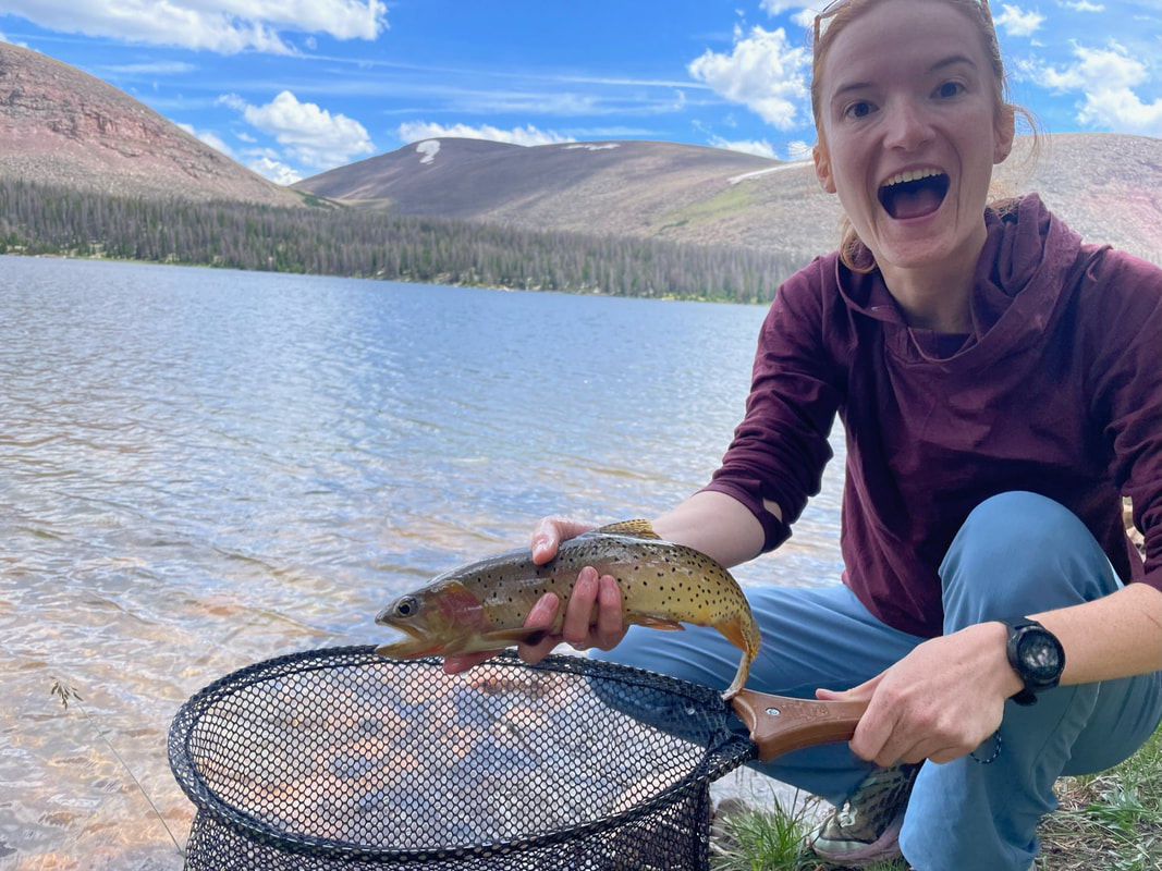
Caught Cutthroat Trout at Fox Lake
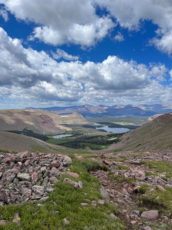
Day 3: Painters Basin, Anderson Pass to Yellowstone Creek – 12 miles
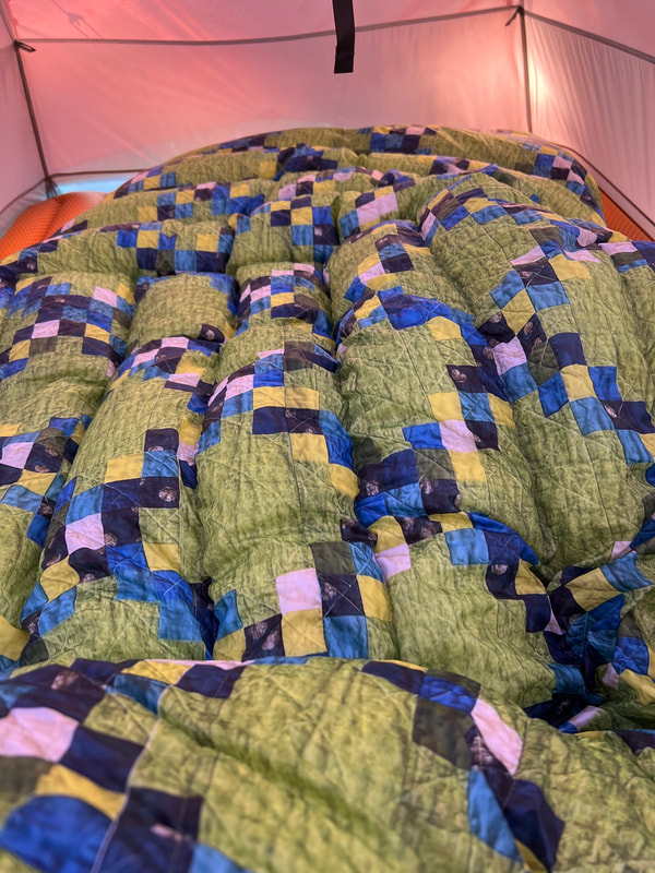
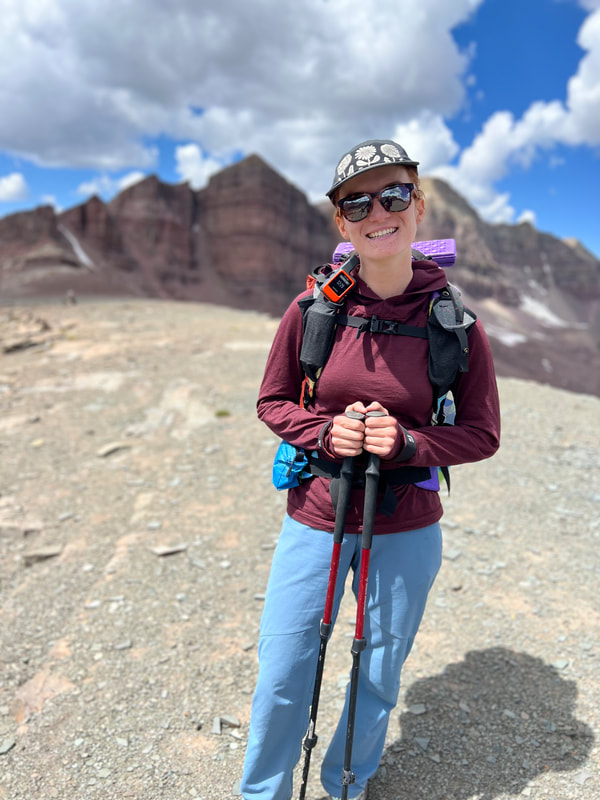
Knowing we needed to get over Anderson Pass before afternoon storms, we woke up before sunrise at our camp, ate a quick breakfast and cleaned up. In the daylight we realized how perfect this camp spot was and felt grateful we were able to keep going from Kidney Lakes, even though my shoe didn’t dry out so I started my day hiking with a wet foot. I'm really glad I brought three pairs of socks, which felt excessive before we left, but was definitely necessary considering I didn’t have waterproof shoes. I was excited for Painters Basin based on our hike a few years earlier, and the hype from trail guides. Unfortunately, it was super rainy and windy as we passed through, so we just hustled to get to the base of Anderson Pass and didn’t stop to enjoy the scenery. We didn’t stop to check the weather at the base of Anderson, we just pushed ourselves as much as we both could to get up and over because we knew if we wavered we’d be bailing out through Henry’s Fork and not finishing the hike. The wind was so intense on the way up Anderson that I got knocked off trail multiple times while getting to the top. I’ve never experienced such strong wind gusts in my life, I tried crying as I continued using every ounce of energy to keep going but I was too dehydrated to drop a tear. Kevin fell far behind me which kept making me nervous but I couldn’t linger. He eventually caught up as my tantrum slowed me down through the awful boulder fields and disappearing trail. When we got to the top of Anderson I turned on my phone real quick, remembering we had service up here last time and we both mustered up half assed smiles to send a pic to our family letting them know we’d made it to the highest point on the trail. There was no doubt we’d be skipping the summit of King’s this time, especially given the wind, and so we began our descent into Yellowstone Creek Basin. The descent was fucking awful, the winds wouldn’t let up, it started raining, then snowing, then hailing. My face and fingers were numb and we were basically sprinting down this pass hoping to get to clearer weather in the valley below. The only thing getting me through the descent was imagining pitching our tent and taking a nap as soon as we got to tree cover. Kevin didn’t think I was serious but as soon as we got to trees I pitched the tent and blew up the pad. It was 1:30pm and Kevin made lunch as it continued to rain and hail. We ate, and then both passed out for several hours. Kevin’s legs were beat and I was just physically exhausted from fighting the wind. After rallying around 4pm we realized I’d pitched the tent on an incline, and generally this was a shitty spot to sleep. The weather had cleared and we could see the full beauty of Yellowstone Creek Basin. We packed everything up and hiked about ½ mile down the trail until finding a better campsite and setting up there. I didn’t really care about our lack of miles that day as we’d made it over our personally biggest obstacle, and there aren’t really good bailout points after Anderson anyway. We knew at this point we were finishing the Highline and we’d be back on track to end by Friday. We nestled our tent in some trees and prepared for a crazy gusty night. We slept right at 11k but I think Kevin was finally acclimated as we both got a great night sleep, although I was feeling quite nauseous around sundown. Temps dropped into the low 30s that night and the double down quilt I made us a few weeks earlier kept us both toasty. 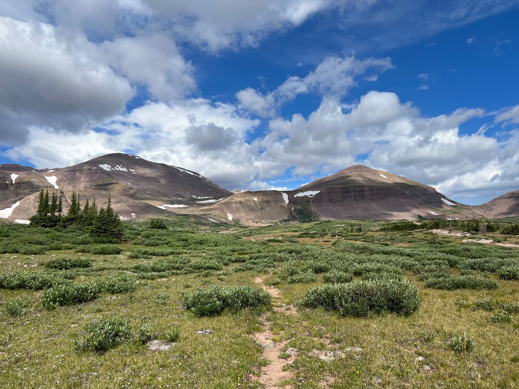
Anderson Pass from Painters Basin
Trying to smile as wind nearly knocked us off the top of Anderson Pass
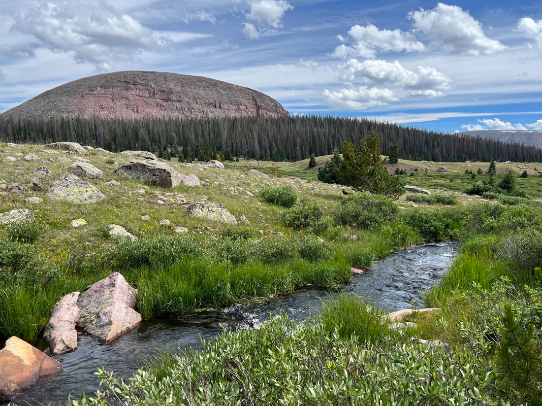
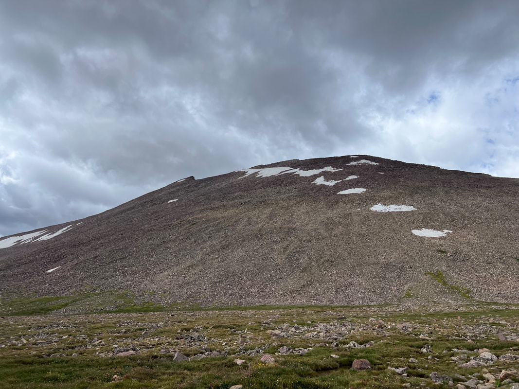
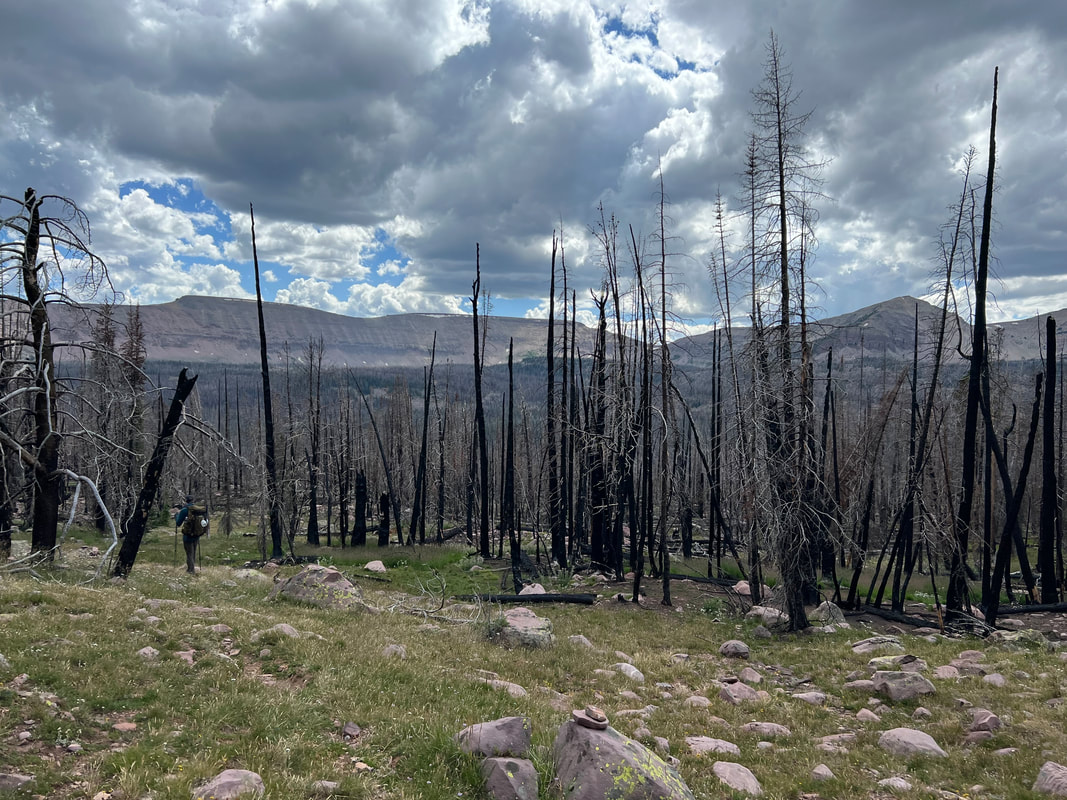
Day 4: Tungsten Pass and Porcupine Pass to Oweep Creek, Lambert Meadows and Lake Fork River – 15 miles
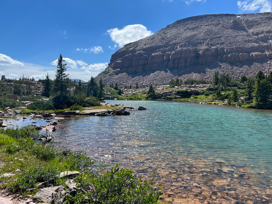
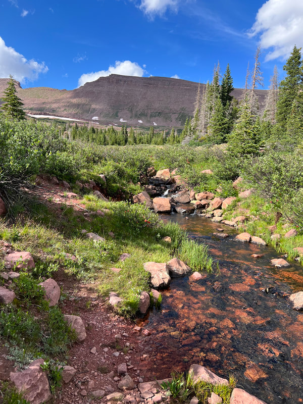
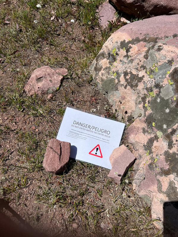
We had a slow morning, still exhausted from the push up Anderson the day before. We had two passes to get over, but Tungsten is basically just a hill and Porcupine felt like nothing after North Pole and Anderson. We spent some time enjoying Yellowstone Creek, did laundry by the river and soaked up the sun. We hit the trail around 9am, knowing this was the one day that promised a 0% chance of rain or storms. Excited at the prospect of the first warm day on trail, I whipped out the shorts I packed and we quickly made it over Tungsten Pass and through the beautiful meadows and lakes to Porcupine Pass. Porcupine Pass was fun and quick, with great views at the top. It made us wish we’d had better weather over Anderson, as we enjoyed taking time to snack and enjoy the views on either side. As we descended into Oweep Creek Basin, we saw a sign from the DWR that said they were working on reintroducing Colorado River Cutthroat Trout to the basin, and that it would be fishless until 2024. Didn’t think much of it and we filled up water at a gorgeous creek, laid out our undies to keep drying from the morning washing, and ate lots of crackers, cheese, and hummus. As we continued down the trail into the basin we came across a sign that said “DANGER” and that water had been treated with Rotenone to kill fish and that we couldn’t fish, swim or wade in the water. However, it didn’t say anything about drinking the water, which we’d already done a few miles upstream. This sent us into a little spiral and motivated us to get through this basin as quickly as possible to access water in Lambert Meadows where we’d planned to sleep. Cue more wet feet as I navigated marshy grasses throughout Oweep Creek. We made it up the ledge on our way to Lambert Meadows and made it to the most incredible lake we’d seen on this hike. It’s not on the AllTrails map but holy crap its there just sitting right at the base of some peaks and on a ledge above the basin. We hung out here, dipped our toes and I scrubbed all the dirt off my legs from hiking in shorts for the day. This is also when I noticed the sunburns and scrapes and really wondered why on earth people hike in shorts ?. After finishing up at Paradise Lake, we made our way to Lambert Meadows and ran into another thru hiker who immediately asked if we also drank the poison water. Thank god we weren’t the only ones who drank it before seeing the sign, he was super spooked by it too! We set up camp a little way from a stream, and finally tried the chocolate pudding dessert I brought. It was so delicious and made us wish we’d brought more! Lots of deer were around the camp, and we went to bed early knowing we had two big passes to get through and storms would roll in around 12.
View as we began the ascent to Porcupine Pass.
At the top of Porcupine Pass
Paradise Lake, above Oweep Creek Basin and before Lambert Meadows.
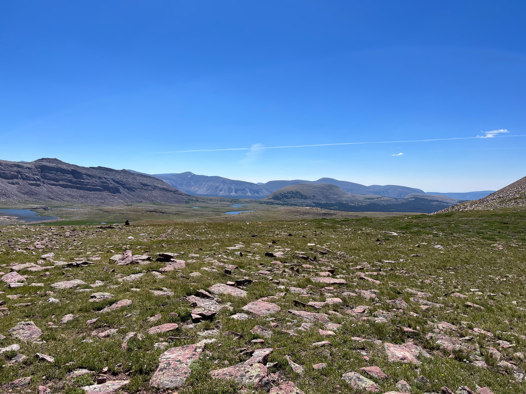
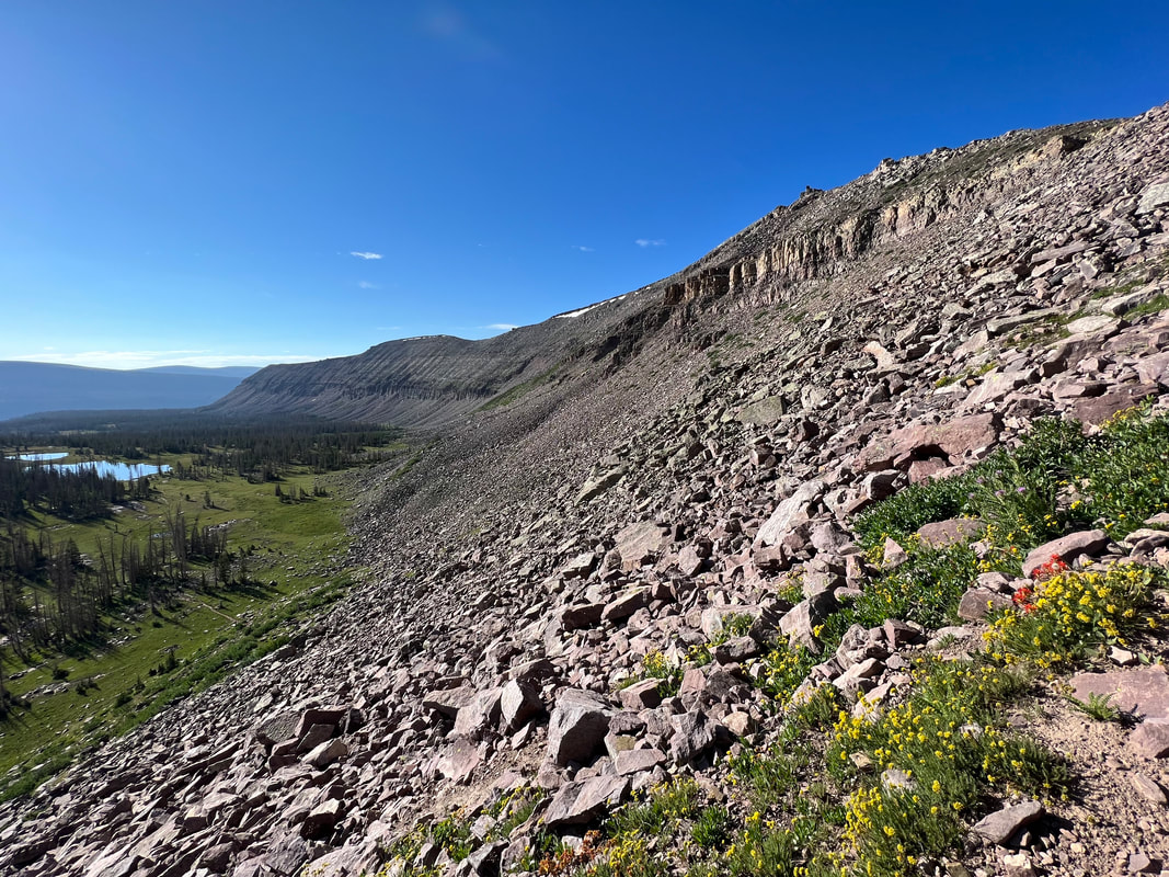
Day 5: Red Knob Pass, Dead Horse Lake, Dead Horse Pass, Rock Creek Drainage – 18 miles
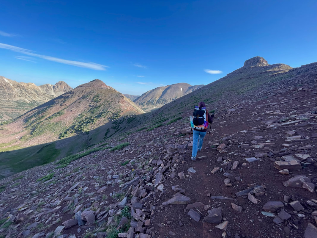
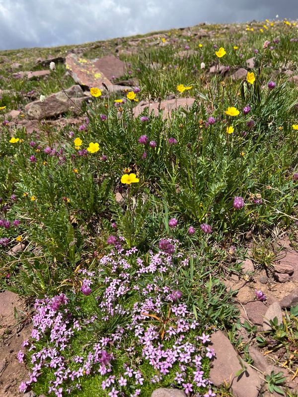
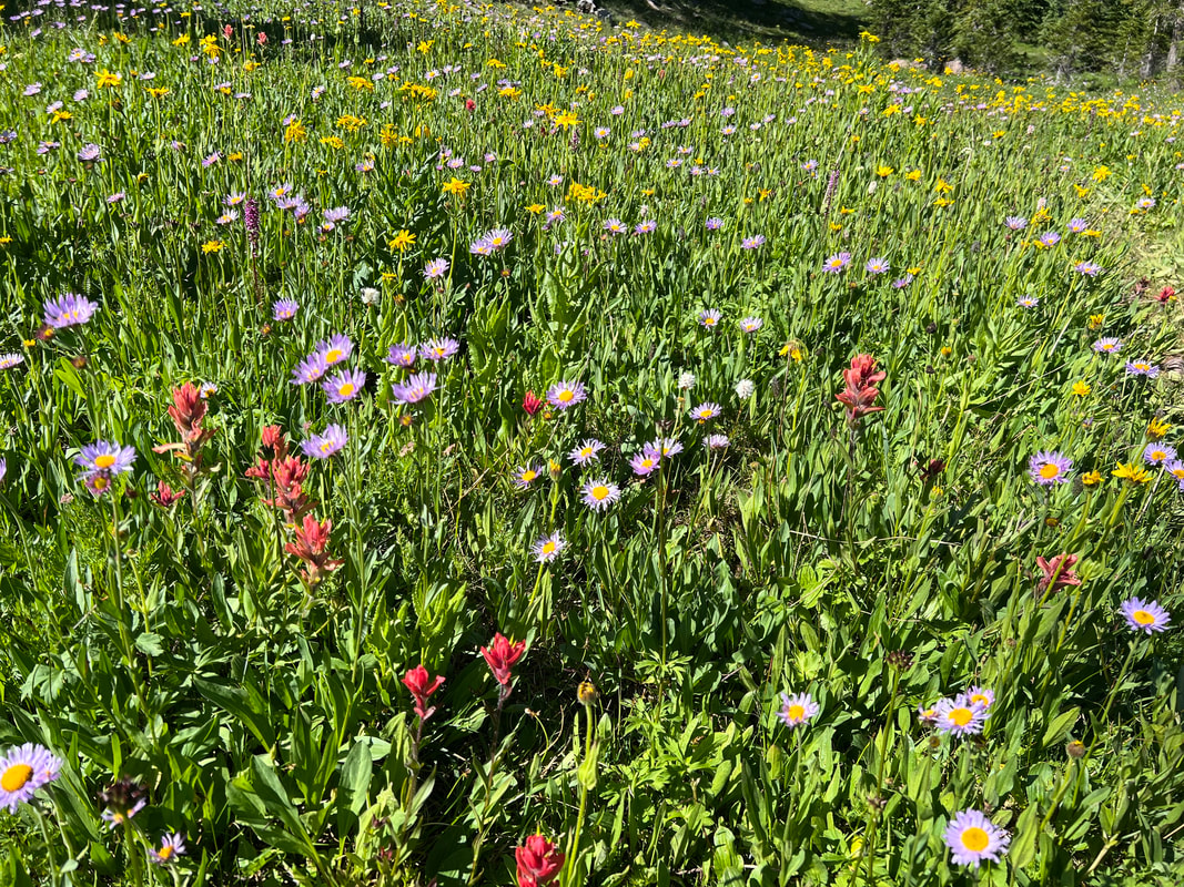
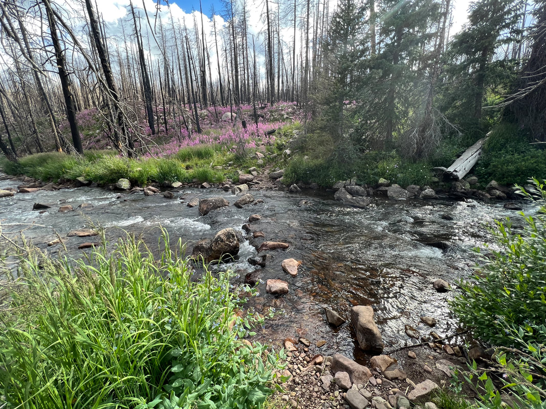
With both of us finally feeling really in it, we woke up before sunrise and quickly took down camp, ate granola bars instead of oatmeal for breakfast and were on trail by 7am to get over Red Knob Pass. The weather was incredible and we watched the sun rise slowly over the surrounding peaks. Red Knob pass itself was gorgeous. Tons of wildflowers the whole way up, and the views of the basin below were amazing. It got hot quickly, and we made it to the top by 8am only to be shocked at the views on the other side! About 1/3 of the way down the pass we were at the top of another pass and could see into two new valleys below. The descent was rough, with loose and steep rock, so we definitely understood the warnings to only hike the pass when it’s clear weather and had time to dry out. At the bottom of the pass we took a break and prepared to make it to Dead Horse Lake where we’d have lunch, fish and enjoy the views before embarking on Dead Horse Pass. We both caught Tiger Trout, ate a ton and then started to get anxious at the clouds forming overhead so we packed it all up and began ascending Dead Horse Pass. The pass was absolutely brutal, by far the most strenuous pass on the trail. There was a snowfield right along the trail, but it was too sketchy to risk crossing so we navigated the boulder field under the snow, and man that was rough. Any slip would lead to a several foot drop through massive boulders and definitely lead to injury. We stumbled upon what definitely looked like animal bones, and the whole time I kept wondering how anyone could think taking a horse through this pass would be a good idea. Definitely a fitting name! The trail completely disappears at multiple points, and Kevin and I had to be careful on switchbacks to stay close together. If either of us was below the other on the switchbacks we’d risk triggering a rock slide onto the person below us. I fucking hated going up this pass but I can’t imagine how anyone could make their way down. The views at the top were incredible but I still hated the pass. The descent was way better, a whole different experience! We made our way to Ledge Lake, knowing we were entering the remnants of the 2020 East Fork Fire, but it was so hard to find info on trail conditions before starting this hike. We’d initially planned to camp at Ledge Lake, but when we got there it was barely 1pm so we decided to push towards Rocky Sea Pass. We kept toying with the idea of getting home that day, so that motivated us to power through. I knew some folks were circumventing the burn area by going through the Jack and Jill trails north of the Highline, but it added a few miles and we weren’t sure of the conditions up there. So we tried to stick to the highline through Rock Creek Drainage. The trail was brutal but there were some signs of recent trail maintenance. We followed a mix of cairns and pink tags on downed trees, still having to bushwhack a ton to get around downed trees. After several hours we made it to Rock Creek, which we’d been holding out hope for a water refill and snack. We were absolutely heart broken when we got there to realize we couldn’t find a safe passage across the river. It was raging and deep in many places. Maybe we were playing it too conservatively but we spent 30 min trying to find a safe way across. After I’d fallen in on a much less treacherous stream crossing a few days prior, we really just wanted to avoid injury. We hung around and ate hoping we’d work up the courage to cross, but eventually took a detour route to get up to Jack and Jill hoping that would be easier. I cannot emphasize enough, this was the worst trail conditions we’ve ever experienced. It was 100% bushwhacking. Every time we thought we’d found a clear section of trail there’d be a dozen downed trees to navigate around. This 1.5 mile section of trail took us almost 2 hours to get up. Then when we finally got back on Jack and Jill trails, it was more of the same. Kevin ripped his pants, I had a breakdown. It sucked. We were miserable. We finally made it back to the junction with the Highline around 8pm, and decided to call it and set up camp. We were so mentally and physically drained from hours of bushwhacking and a several mile detour from the trail. We hadn’t seen another soul the whole day, until around 8:30pm when a hiker came down the trail as we set up camp. Immediately he yelled out “you’re the first people I’ve seen all day! Thank god I need someone to commiserate with!”. He said he’d hiked Kings Peak as an out and back from Hayden and stayed on the Highline through Rock Creek Drainage on the way there, but it was so horrible he decided to try Jack and Jill on the way back, which was equally awful. This validated that no matter which way we’d gone it would have sucked. This guy had an impressive long trail history and was adamant he’d never been on trail conditions this bad. It validated our melt down and exhaustion from what turned into a horrible end of our long day. 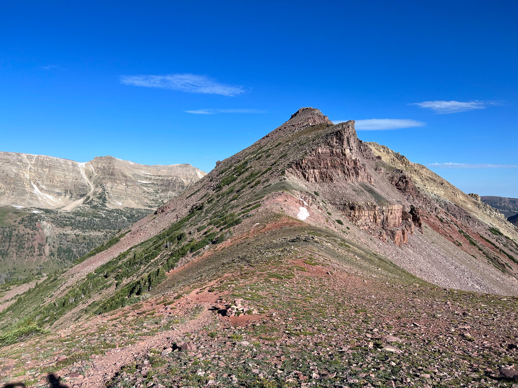
View as we descended off Red Knob Pass.
Climbing down from Red Knob Pass
Fucking hated Dead Horse Pass
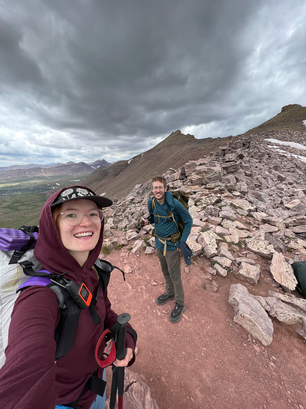
Took some pics at the top as we mentally recovered from how gnarly this pass was
Day 6: Rocky Sea Pass, Carolyn Lake, Home! – 12 miles
Thank god we got a good night sleep after how sore and tired we were from navigating the Rock Creek Drainage section of this hike. We were worried we’d be too slow to beat the 80% change of lightning at 11am that the inReach weather report showed coming. Our tent was covered in condensation, the worst it had been the whole trip. Didn’t have time to dry it out so we shoved our wet tent and damp down bag in the stuff sacks and hit the trail before even really eating. Once we got up to about ¼ mile from Rocky Sea Pass we were out of the timberline and down with the horrendous trail conditions. The basin at the base of Rocky Sea Pass was gorgeous, I wish we’d made it slightly farther down trail to camp there. Rocky Sea pass itself was pretty easy and felt amazing knowing how close to the car we were! We’ve done tons of hikes from Hayden Pass Trailhead so we’re very familiar with the trail on the west side of Rocky Sea Pass. We stopped at Carolyn Lake to eat a hot breakfast and fish. We both caught lots of Arctic Grayling, then hit the trail to head home! After barely seeing other people for a week, it was shocking how many folks we ran into on the trail that morning. We got increasingly annoyed at the hoards of horse packers on trail, the kids screaming for no reason egged on by their parents, and ended up doing the last five miles as basically a trail run to the car. I always forget how endless this section of trail is, no views and nothing particularly enjoyable. The trail is a consistent uphill climb and very rocky, but with all the tree cover there just aren’t many sights. All good, we made it to the car by 1:30pm and the feeling of accomplishment was unreal! Thunder loomed overhead but we just missed it and got changed into our car clothes and hit the road home! 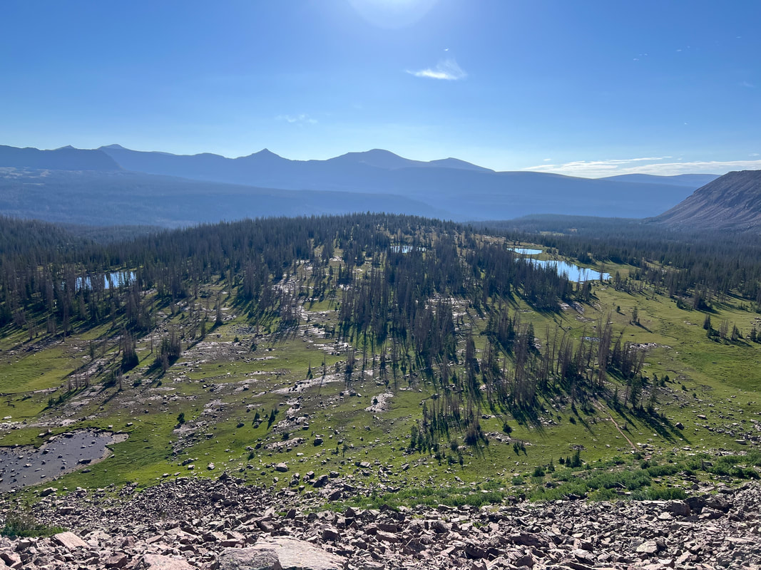
View of the Rock Creek Drainage from Rocky Sea Pass
Made it to the Hayden Pass Trailhead!!!
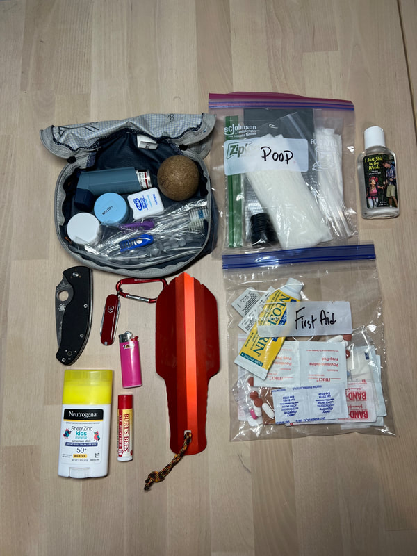
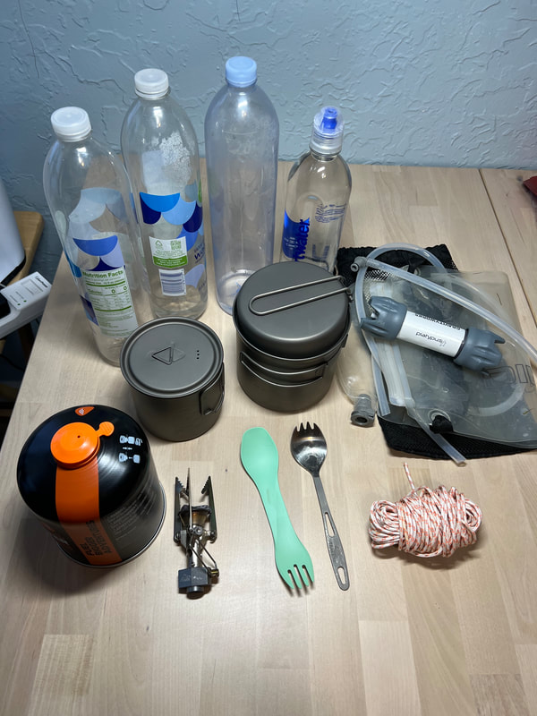
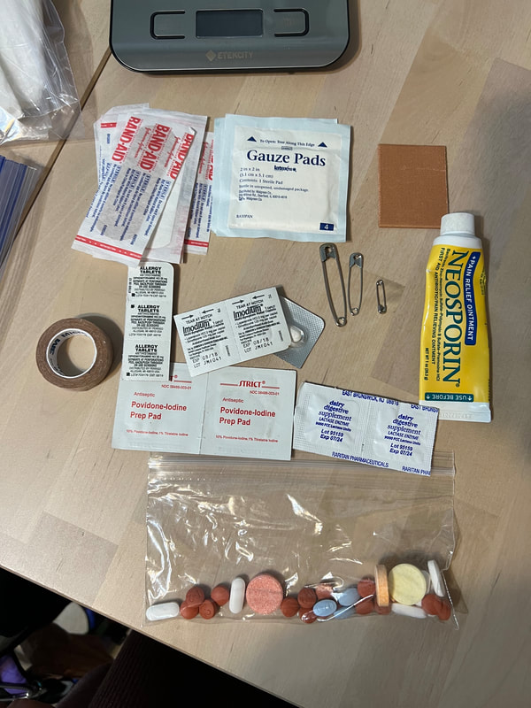
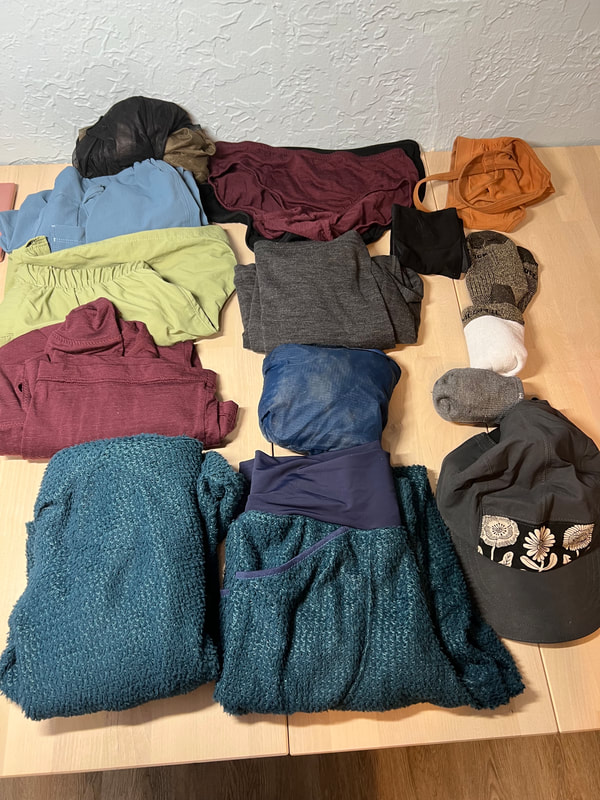
Gear Thoughts
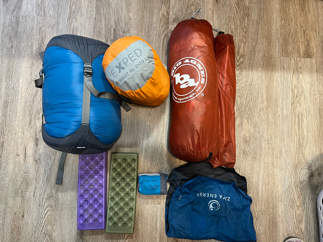
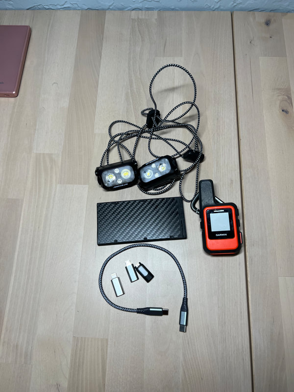
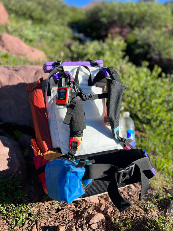
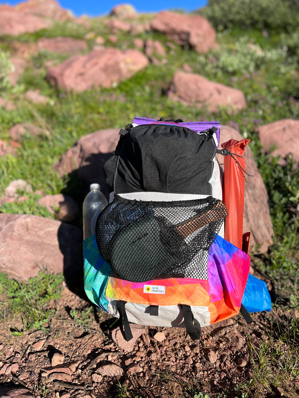
With sharing gear, we each had an approx. 11lb base weight which included over a pound of fly fishing stuff. We had approx. 18lbs of food total, and each carried about 1L of water at a time. Total pack weight on day 1 (after cutting food and ditching our second liter of water) was 24lbs for me and 28lbs for Kevin. Honestly neither of our pack weights were ever an issue. It definitely felt great by the last few days to each be carrying sub 15lb packs, and we were able to cover more mileage those last few days. We couldn't really identify or at least agree on any major areas to cut weight for this trip. The fishing brought us joy at some of our lowest points, and honestly just made down time more fun. The double pad + quilt gave us great rest that allowed us to power on. Kevin is adamant about maintaining a separate pot to just boil water in for tea + coffee, so that's why we have two pots. We wavered a bit on whether or not we needed two battery packs, but didn't want to risk it and ended up running one dead and using about 1/3 of the other. We each carried two bottles which ended up being unnecessary, never needed more than 1L at a time.
Here's some pics of most of the gear we brought:
Shoes:
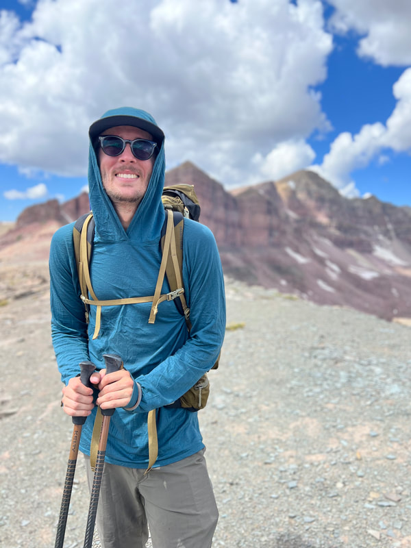
I really regret wearing my trail runners on this hike. The trail was so wet throughout that I wish I’d had waterproof shoes. Thankfully my shoes dried out quickly on trail, but going into camp with wet feet was super demoralizing. Somehow, I came out of this hike without any blisters, which feels like a miracle, but still my feet were wet and sore most of the time. I also wish I’d had a boot with a bit more of a firm sole, the rocky trail made my feet sore by the end of each day. In the end it was fine, the western side of the trail after Anderson was a lot drier, and while I did get wet a few times I mostly managed to keep my feet dry the last few days. If Kevin hadn’t been wearing waterproof mid boots, I wouldn’t have thought much of it, but my only pain point by the end of the hike was my feet and he had dry and happy feet the whole hike (but lots of other sore muscles!) Clothes: I made most of my own clothes for this hike, including my merino sun hoodie, hiking pants, shorts, alpha direct hoodie and sleep pants, merino underwear, and silnylon rain jacket. I also made Kevin’s merino sun hoodie, alpha direct hoodie and merino boxer briefs. We both loved our sun hoodies and even when we got quite stinky they held up, the undies were great and we were able to wash them in streams and they dried super quick clipped to the back of our packs. My rain jacket was perfect, usually when it was raining it was also freezing out so I didn’t mind hiking in it even though it isn’t breathable. Also worked like a charm for wind protection during some of the worst gusts. The mesh pit vents helped a little with body heat and then I’d just unzip as much as I could to stay dry. I loved my hiking pants so much! I made them with a lot of ease and that was perfect because I basically felt like I wasn’t wearing pants – which is perfect. I somehow ended up with lots of cuts and weird scrapes and things on my legs throughout this hike, even when wearing pants, but the pants didn’t get ripped or anything (just a little stained with blood…) They dried really quickly after rain and my accidental dip in the stream. I hated hiking in my shorts the one day I did. I kept applying sunscreen and still ended up with gnarly sunburns on my legs, plus even more scrapes, bruises and bug bites. I also couldn’t pee with my PStyle with the elastic waist shorts and pack on, so the pants with a zipper fly were the winner because I didn’t have to take my pack off to pee. Thumb holes < sun gloves: We both loved the merino sun hoodies I made, but because I hiked with poles the entire time, my hands got a lot of sun exposure. The thumb holes kept the back side of my hand from sun, but my knuckles got so sunburned that I have blistering on several of my fingers. I applied sunscreen every chance I could but it barely stuck to my fingers and now I’m paying for that. Thumbholes are great for day hikes or hikes with less exposure but no amount of sunscreen was a match for the brutal exposure throughout this hike so definitely team more clothes!
Pack:
Holy shit I’ve never had a more comfortable pack. I made this with several features that I’m quite enamored with. The frame stays/suspension system are the best part by far. There were times where It was so hot I didn’t want my pack touching my back and was able to comfortably shift all the weight to my hips and barely have the shoulder straps/back touching my body. When scrambling in the Dead Horse Pass boulder field I got the pack to sit super close to my body which gave me great mobility. I loved having the shoulder strap pockets, all the external pockets, and the hipbelt pouch I made last minute. I got a sore spot on my right collarbone and can’t really figure out the cause. The plus side of making the straps removable is that I can play around with it to figure out the cause and hopefully remedy it. Stoked to take this pack on many more adventures and rally glad to see the seam taping held up. Nothing inside got wet despite tons of downpours!
Sleep System:
I made a hearty double down quilt before this trip. Weighing at 40oz and filled with nearly 2lbs of 900FP down, it’s a warm beast. It’s our first time sleeping with a down quilt, as we’ve been using an apex quilt I made three years ago. I was worried with how wet this trail was that the down would get wet and it would lose loft, but thankfully that didn’t happen! We had a ton of condensation in our tent (Big Agnes Copper Spur 2), which usually doesn’t happen. The nights with strong wind thankfully kept condensation down, but the few dry and wind-less nights got bad. The quilt dried quickly and we never experienced warmth loss, so that was a great relief! Neither of us brought our puffies, so we really relied on the quilt to keep us warm at night. It was great. We each brought a wool base layer top, alpha direct hoodie and then I had alpha direct bottoms while Kevin had wool leggings to sleep in. Cold was never an issue for sleep but we definitely got cold on trail in the mornings and evenings. We both got a little sick of pumping up the exped synmat UL duo sleep pad. We normally love it and get great nights sleep on it, but it takes like 5-10 minutes to pump up and that was a lot when we were already wiped at the end of each day. I don’t know what the alternative would be but this definitely was on our mind a lot. It’s definitely heavier than other sleeping pad options out there and we’ve been sticklers on keeping it since it fits perfectly in our tent, is one of the only pads long enough for Kevin to comfortably sleep on, but pumping it up and taking it down every night wasn’t fun. Water Filter: We went back and forth about taking the Sawyer Squeeze, but we also knew we’d want to take a lot of breaks and didn’t want to spend our downtime actively filtering water. We usually take our Platypus Gravity Filter with us, so we decided to just stick with what we know. We got into a good rhythm of taking 10-minute breaks by streams, filling the bag and sticking it in a tree or on a rock to filter while we ate and rested. This worked well and we’d usually fill four liters, each drink one and then carry a liter with us on trail. We never needed more than 1L on us at a time. This kind of forced us to rest every 5 or so miles, which was probably for the best. TL,DR:
The UHT was a wonderful hike and definitely pushed us mentally and physically at times. I'm really glad we did it. We barely saw other people each day, got to experience some of the most beautiful landscapes on earth, and hiking is just fun and awesome. We didn't crush massive miles or do anything particularly impressive, but it was fun and I'm excited to experience more long trails and keep putting miles on all my handmade gear!
1 Comment
Ellen
8/13/2023 02:37:10 pm
Congrats on the big trip! I had a thought about how to make the elastic waist shorts more functional. Men’s traditional woven boxers have an elastic waist and a flap-type fly with a button/snap or two to keep it closed when it’s not being used. It’s like elastic waist shorts with a faux fly, only it’s real! Would that work for using your pstyle and keeping your pack on? Leave a Reply. |
About FrancescaI got my first sewing machine middle school, circa 2005 (although I don't remember learning much in the way of sewing). After a long hiatus, I was reunited with my machine in 2019. I re-entered the hobby through gear-making, and have been crafting a handmade wardrobe since late 2020. I have a real affinity for comfy clothes (secret pajamas) and all the colors! Archives
August 2023
Categories |


 RSS Feed
